The Boulder at Paidge Avenue and Provost Street
“When entering from Provost Street and Paidge Avenue, you will discover two large boulders at the corner. The granite stone was found a few blocks away during a street reconstruction, though it first arrived in Greenpoint during the last Ice Age.”
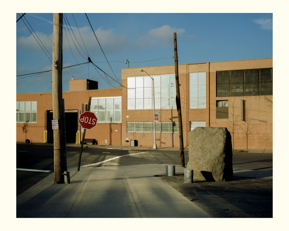
The time stamp on the file says I scanned the negative on October 3, 2012 which means I likely made the photograph during that spring or summer while on a late afternoon walk in Greenpoint, Brooklyn, where I was living at the time.
It’s one of a handful of landscape photos from my first four years in New York City that I’ve kept in a review pile. I've always liked the photo because of the light and collision of elements on the street corner, but never found a place for it in an edit.
In the last few years as my projects have focused on walking, green spaces and parks, a few of these photographs from the review pile have become more intriguing because in many instances there's missing information, such as a location or specific time.
At some point last year, I pulled out the boulder photograph and made a 5x7 print to hang on my wall. Taping photos to the wall so you can see them daily is a good way to trigger new ideas and inspiration.
The first thing I wanted to figure out was the exact location of the photograph. I knew it was Greenpoint and with the street sign easily visible, it wasn't much of a mystery, like trying to find the location of an enigmatic Ansel Adams photograph.
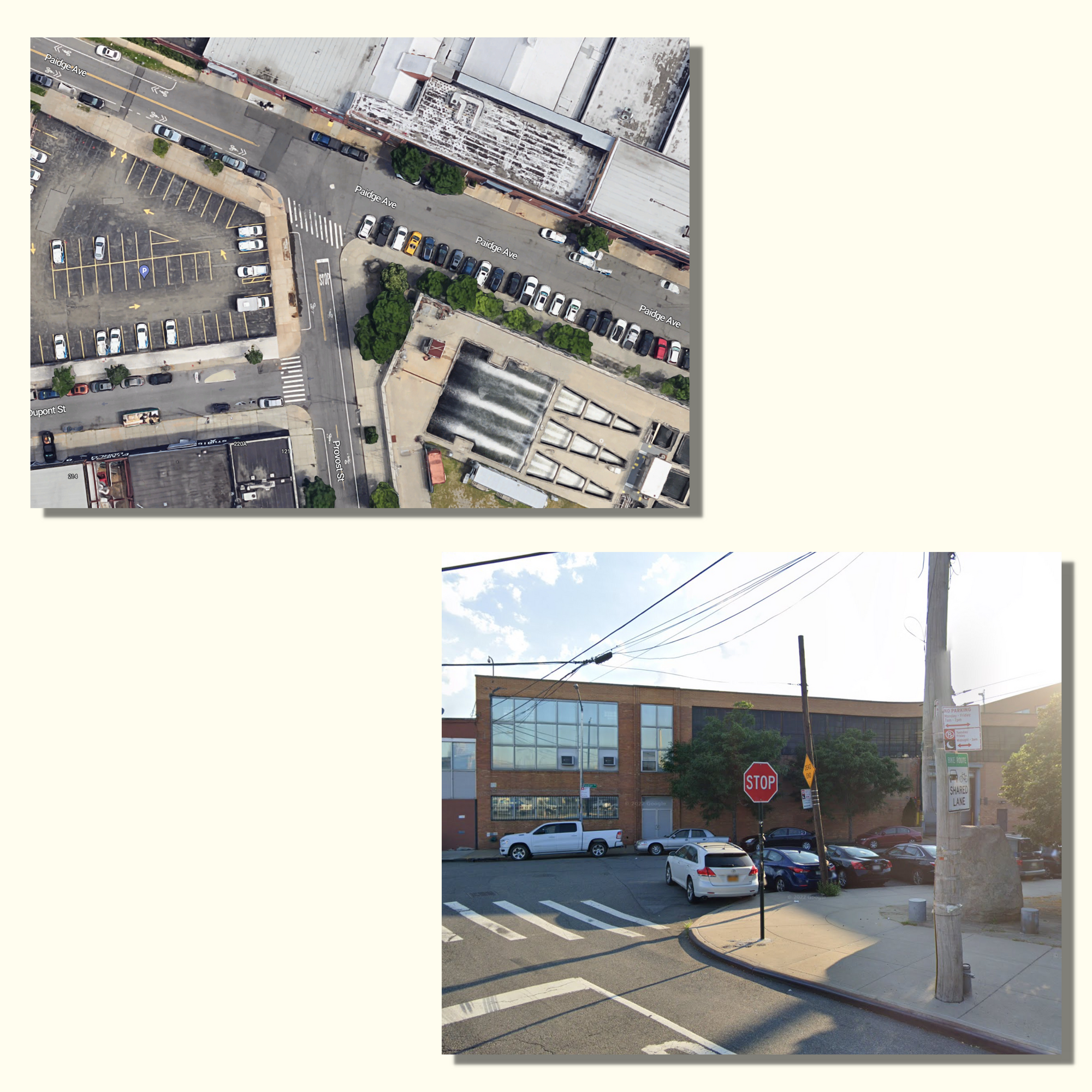
A few clicks on Google Maps, and I was there at the corner of Paidge Avenue and Provost Street, on what looks like was another sunny day.
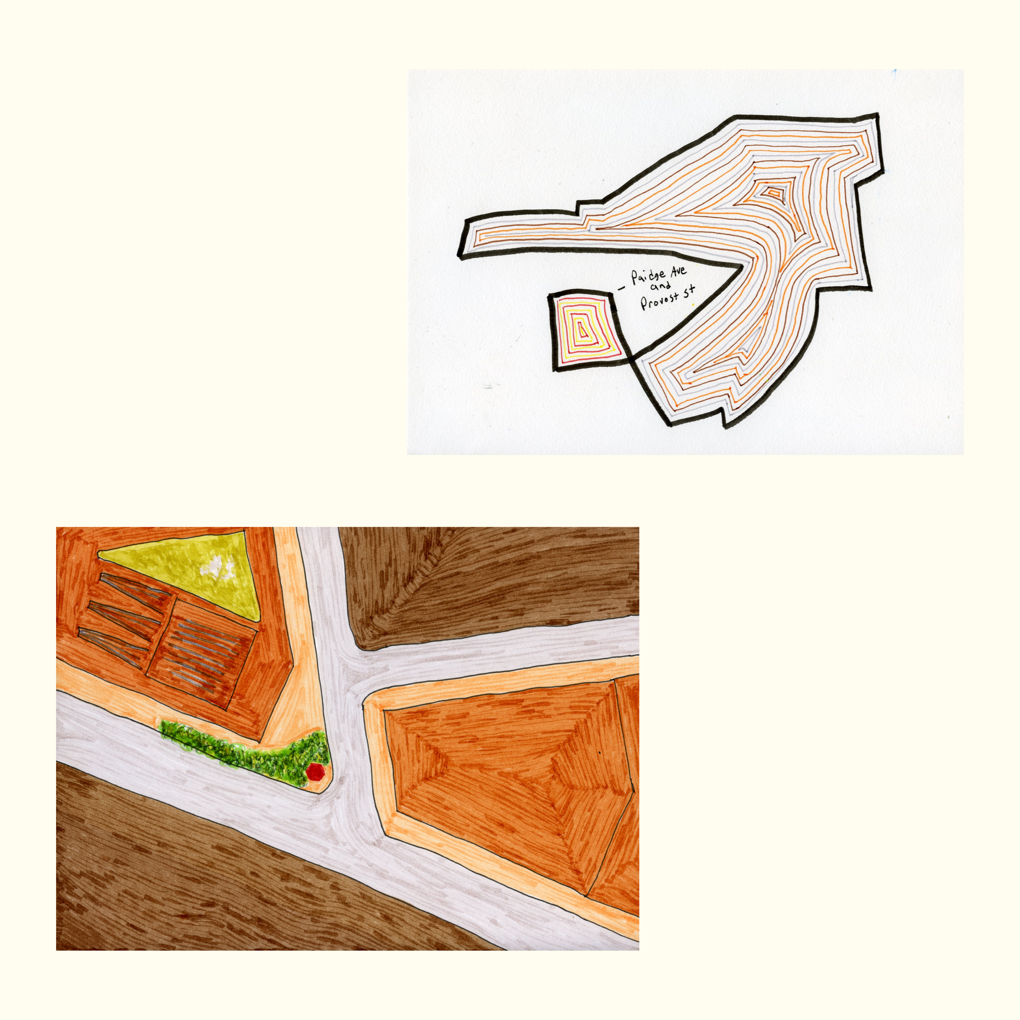
At the time, my maps were minimal sketches of the outline of walks I recorded on Strava. I didn't have any walk data for this photograph so instead I made an outline of a hypothetical walk. I tossed it in my pile of drawings and forgot about it for several months as I worked on other projects.
Over the last two years I've accumulated a growing number of Google Maps. I love how I can easily zoom in and pull back on a location to gain a different perspective and broader understanding of the geography.
I've plotted photographs, green spaces, desire paths, and other aspects from my long walks through NYC and now Saint Cloud on various maps. This has inspired me to think about the work in a different way, and make connections in the walks and landscape that I haven't made while on the ground.
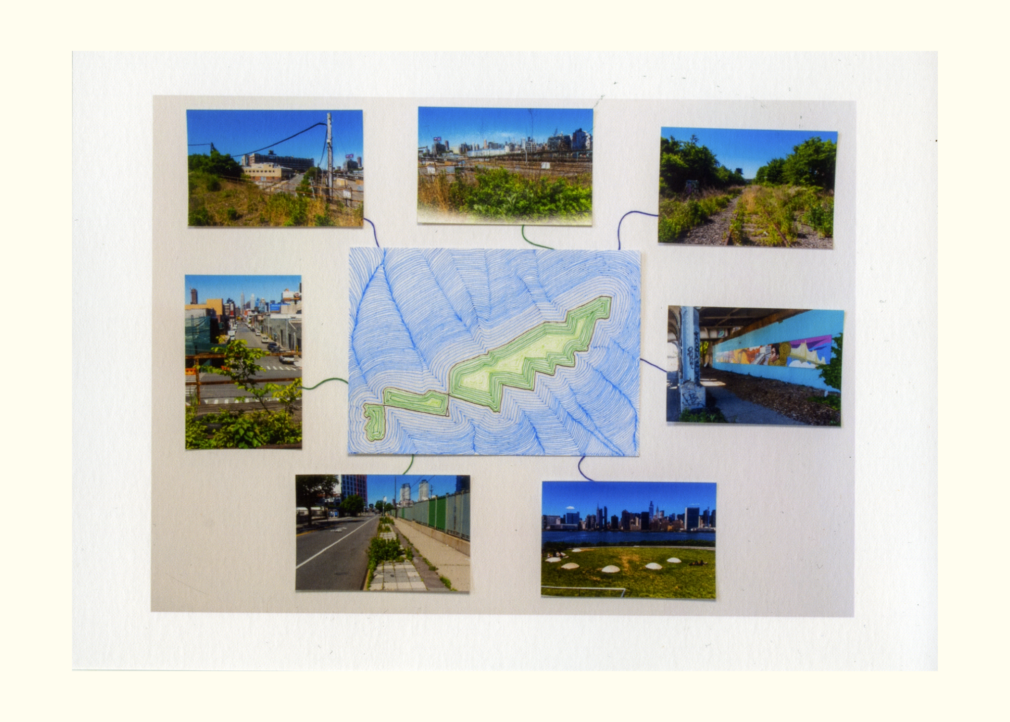
I decided to draw a map of this location to see what that would inspire. It’s the first time I’ve made a map based on a specific location of a photograph, rather than from one of my walks.
As I looked at the photograph and the map together, I knew I needed a broader view. I needed to zoom out.
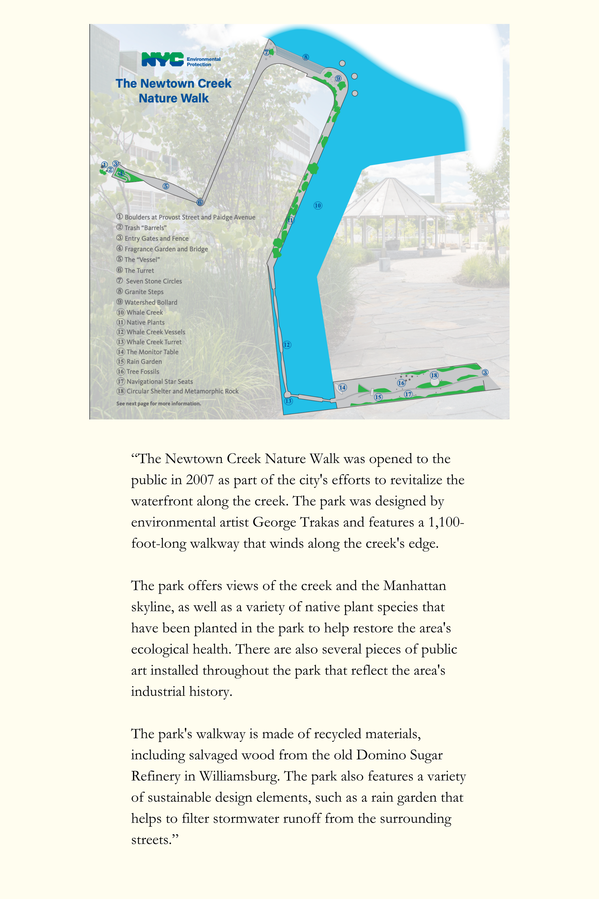
For all the years I've looked at this photograph, I never realized it was one of two boulders at the entrance to the Newtown Creek Nature Walk.
I chuckled to myself because it's one of the parks I'd never visited, which seems odd since it's right in the middle of a part of the city I walked so frequently I can close my eyes and see many of the views.
I don’t know why I never visited it. Perhaps I avoided Greenpoint because it felt overly familiar from living there for several years, so I sort of forgot about it.
I found this intriguing because most of my focus has been on the places I've walked to and visited. For whatever reason, I hadn't thought much about the places I didn't visit.
During my research, I found a New York Times article from 2009 headlined: The Ironic Nature Walk.
"The nature walk occupies an unsavory wedge of land, stuck as it is between a sewage treatment facility and the infamous creek that separates Greenpoint, Brooklyn, and Long Island City, Queens, where decades ago more than 17 million gallons of oil seeped in from underground tanks. Yet, this contradictory nature walk, with its bleak concrete paths, holds truth for our confounding times."
After reading that, how can you not want to immediately visit? I started to think about all the walks I made to the that part of Queens, along the Queens Midtown Expressway and Calvary Cemetery, and how that sense of industrial grittiness was often an inspiration in an odd way.
"Past the boulder cairn at Paidge and Provost is a symbol of who we are and what we have made here on earth, like it or not an unusually honest space in which to contemplate the nature of our city and our civilization.
As much as we have created the grand cultural playgrounds of Manhattan, we have also created the wretchedness of Newtown Creek. The two worlds need each other and cannot be set apart, though much of our economic system takes great pains to encourage the illusion that this is not the case."
As bleak as it sounds, that sentiment makes me feel optimistic. Building a park at that location demonstrates that New York City is world class when it comes to innovative public green spaces.
As I've detached from New York City as a home, I've started to imagine what the future city might look like and if it could evolve into one of the great biophilic cities in the world. I believe it can, especially if more space is reclaimed from the destructiveness of car culture.
During the first few months of Covid, I made several walks to Hunters Point Park South at the tip of Long Island City. It's one of the newer parks in NYC, and has received praise for it's innovative design and approach to sustainability. I have a few different series from those walks that I'm working that will likely connect to this piece in some form.
The route from my apartment often took me down Skillman Ave which runs along Sunnyside Yards, the massive train yard owned by Amtrak.
There’s an abandoned elevated rail line called the Montauk Cutoff that you cross as you head toward 49th Ave. I'd always noticed the small path winding up to the tracks, so figured people were going up there for various reasons.
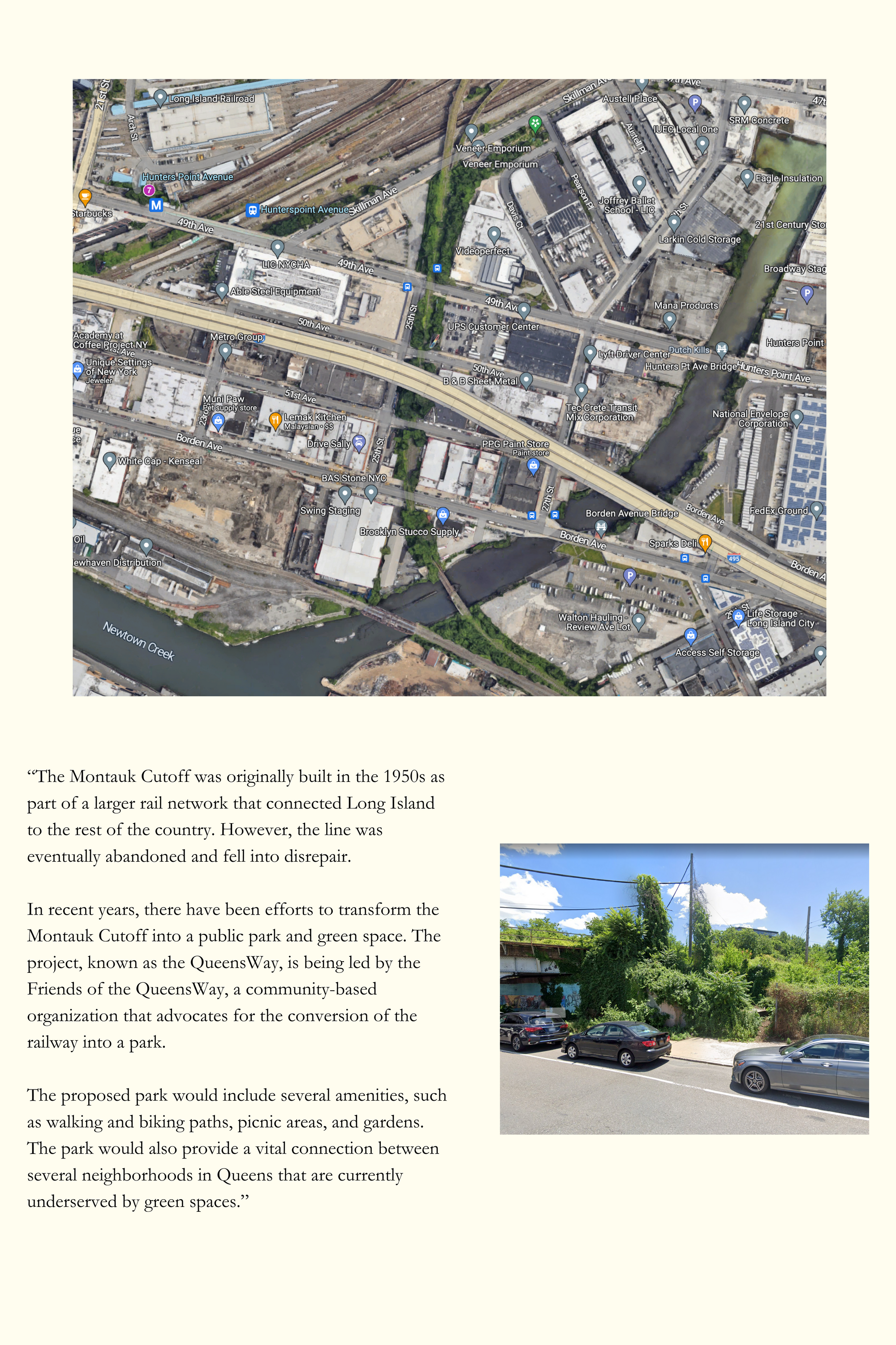
On this day, I decided to walk up and check it out. Right when I arrived at the tracks, I noticed another photographer up in the distance so figured it was all clear for exploration.
I am not advocating trespassing, as there are of course certain dangers, but this spot seems solidly safe if you're in NYC want to seek out the path.
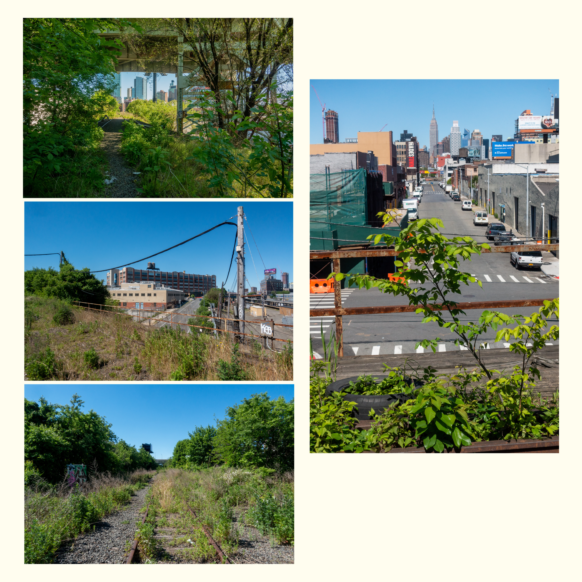
I walked around, made some photographs, admiring the view and imagining it as a park. It reminded me of the Highline in Manhattan which has amazing views but is often so busy that it's hard to enjoy it. It also reminded me of riding the elevated 7 and N trains, where you get that moving view of Manhattan as it collides with growing LIC skyline.
As I was walking I heard a couple of guys yelling up at me. I thought they were there to kick me out but it turns out they were graffiti artists.
They asked if I was a ‘writer’ and I was initially confused, and said no “I’m a photographer.”
I told them there was a path and they could come up. They said thanks and moved on toward the path.
After a few more minutes of walking in the opposite direction, I arrived at a point where the path narrowed and was more covered with vegetation which I took as a signal it was time to leave, so turned back and continued onto Hunters Point.
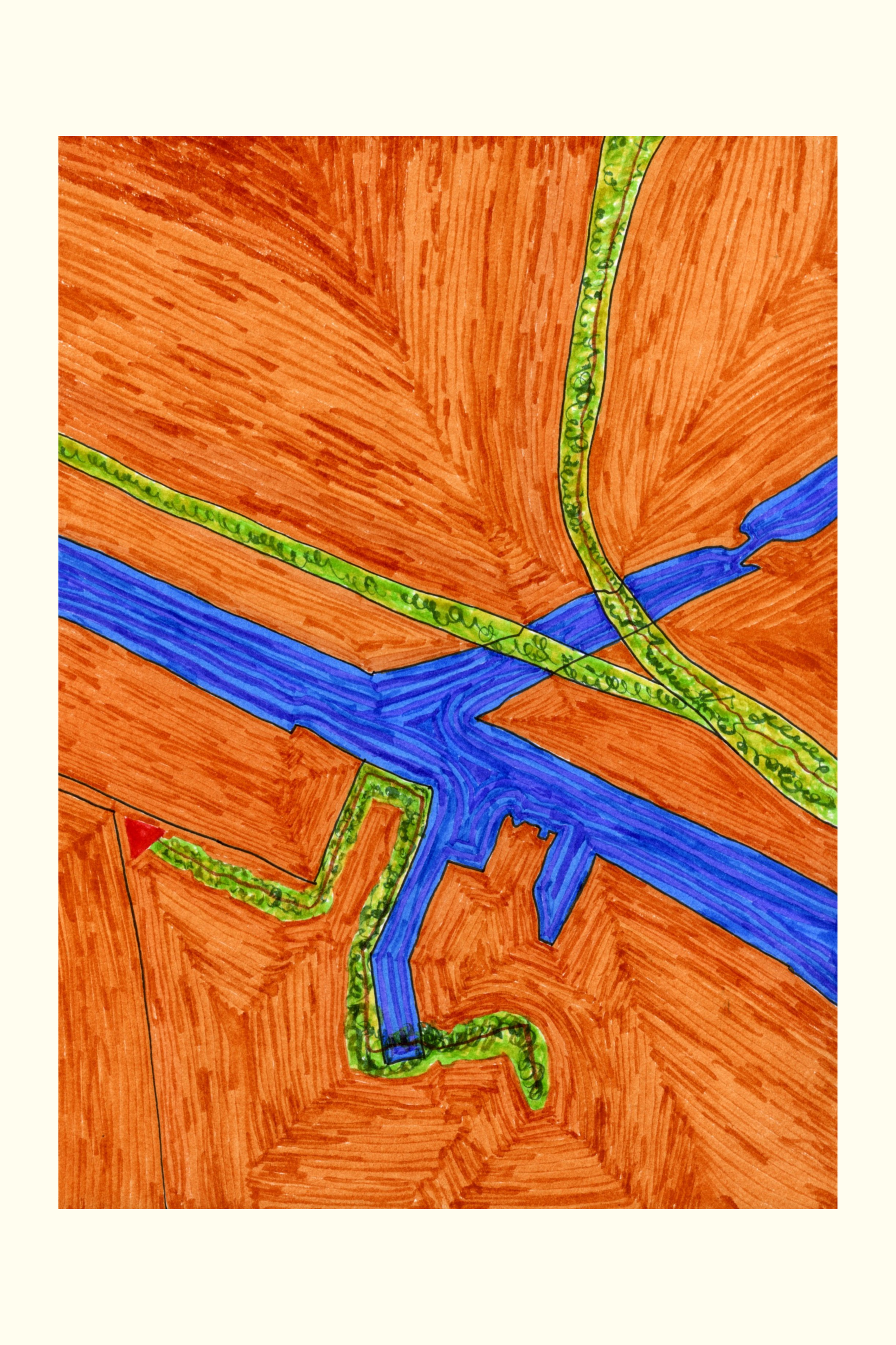
Looking at the map, the connection was clear. I knew this is what I wanted to draw to explore this idea of connecting locations and memories on the map. I can't help but look at the map and wonder how it will be filled in with more green space in the future.
This area is heavily industrialized, so it won't be easy but it also makes it a prime spot for revitalization and innovative approaches to developing green public spaces.
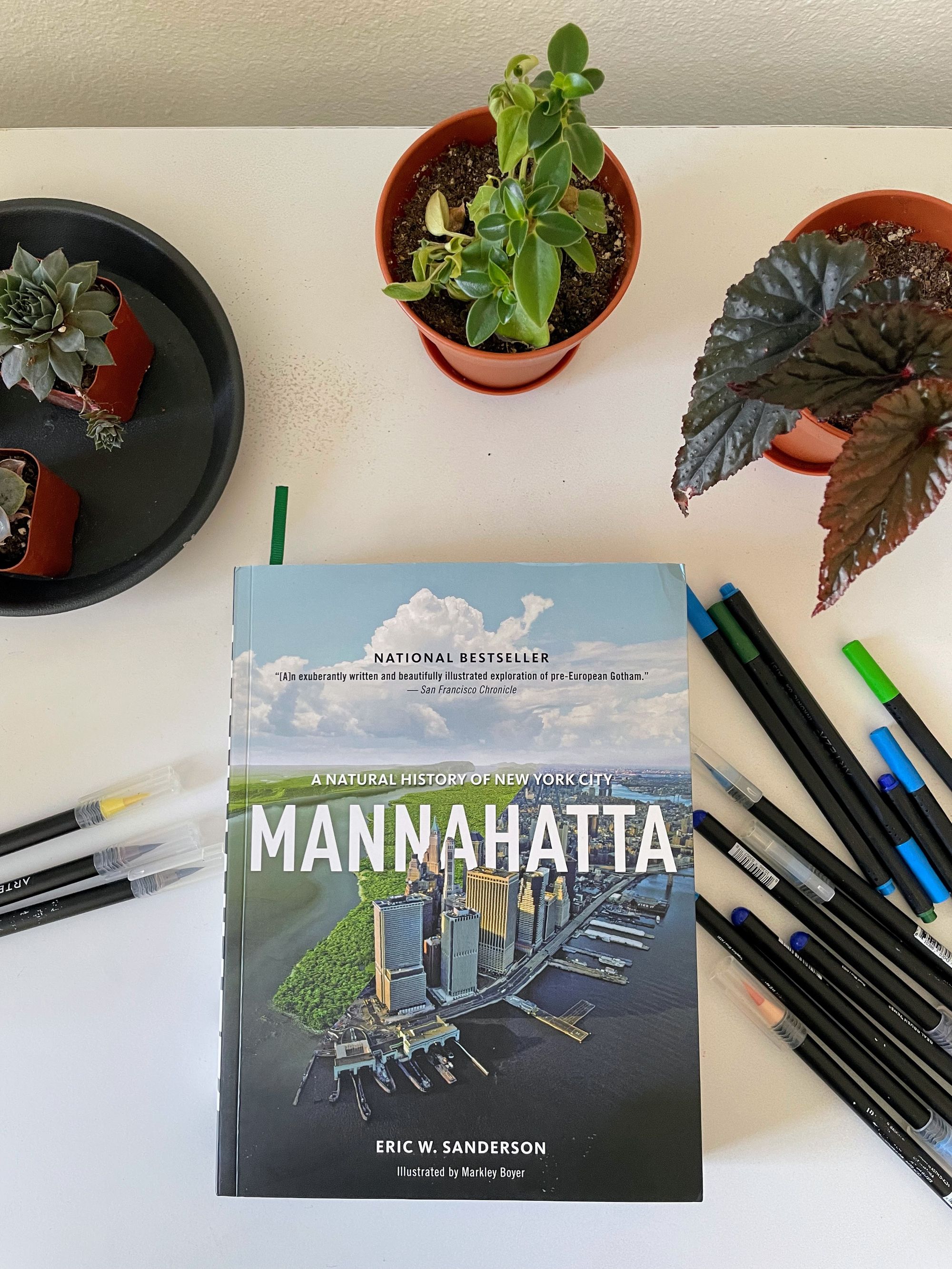
I recently started reading Manhatta by Eric W. Sanderson (Thanks Alex Wolfe). It’s a fascinating book about how Manhattan and NYC have transformed the last 400 years and offers a somewhat optimistic vision of how it will transform into a biophilic city of the future.
As I progress deeper into the project and explore my memories of these green spaces, I'm frequently thinking about how they might be viewed in the future as the building blocks for the future forest city.
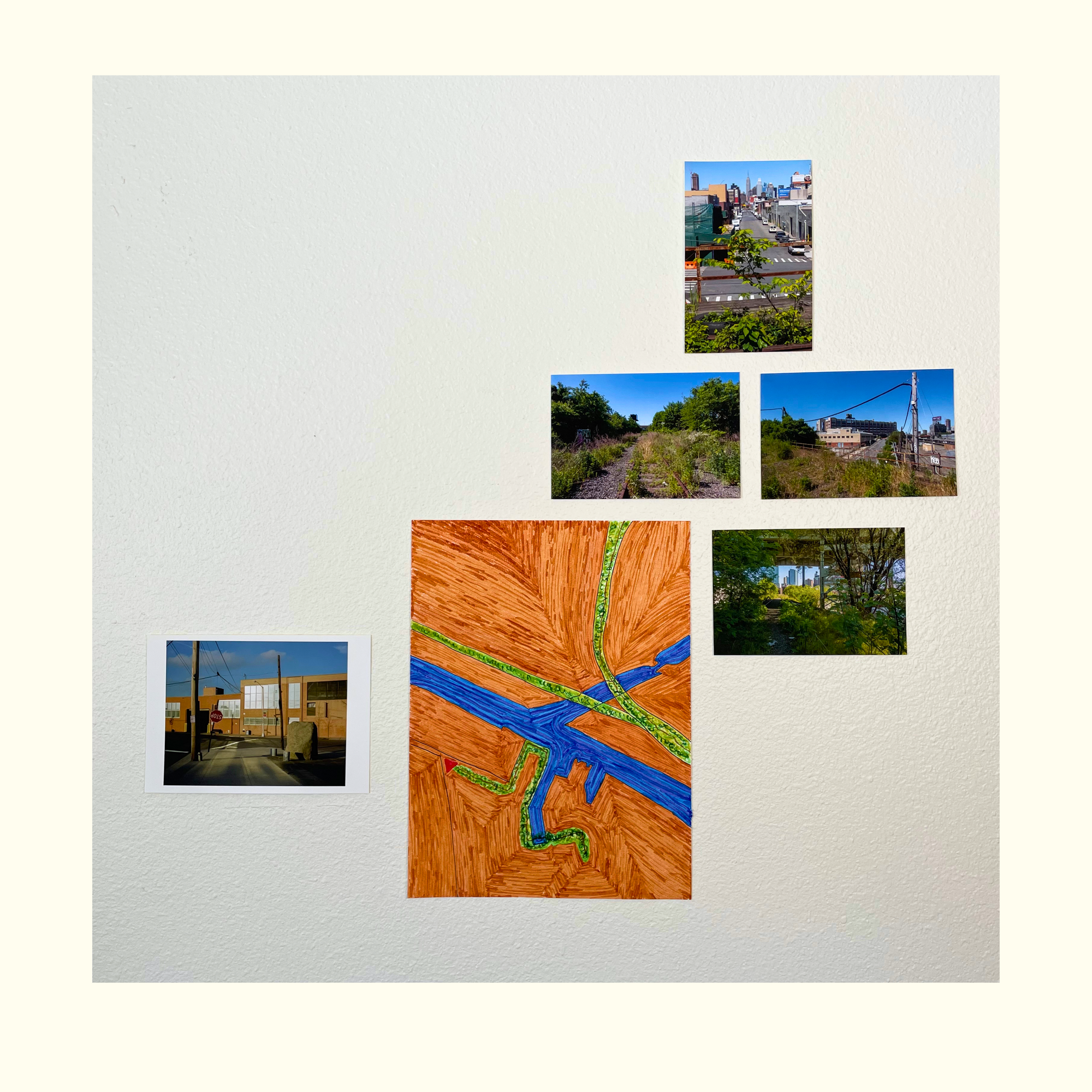
I taped the map and photos to the wall to see how they'd look together. It's an important part of the process and I've found the physicality of printing, taping and moving the work around aligns with the sensation of walking and thinking in a strange way. It feels like an extension of the walk, working in harmony.
Movement, it seems, is central to staying inspired for me.
Making the work and meditating on these public spaces is what motivates me to keep progressing and challenging myself, despite how unpolished the results might be at the moment.
It keeps my mind humming along, but what I find more intriguing and inspiring is considering and wondering how these public spaces are experienced by other pedestrians and artists.
It's a feeling that connects me deeper to these locations which I believe are integral to our mental and physical well being.
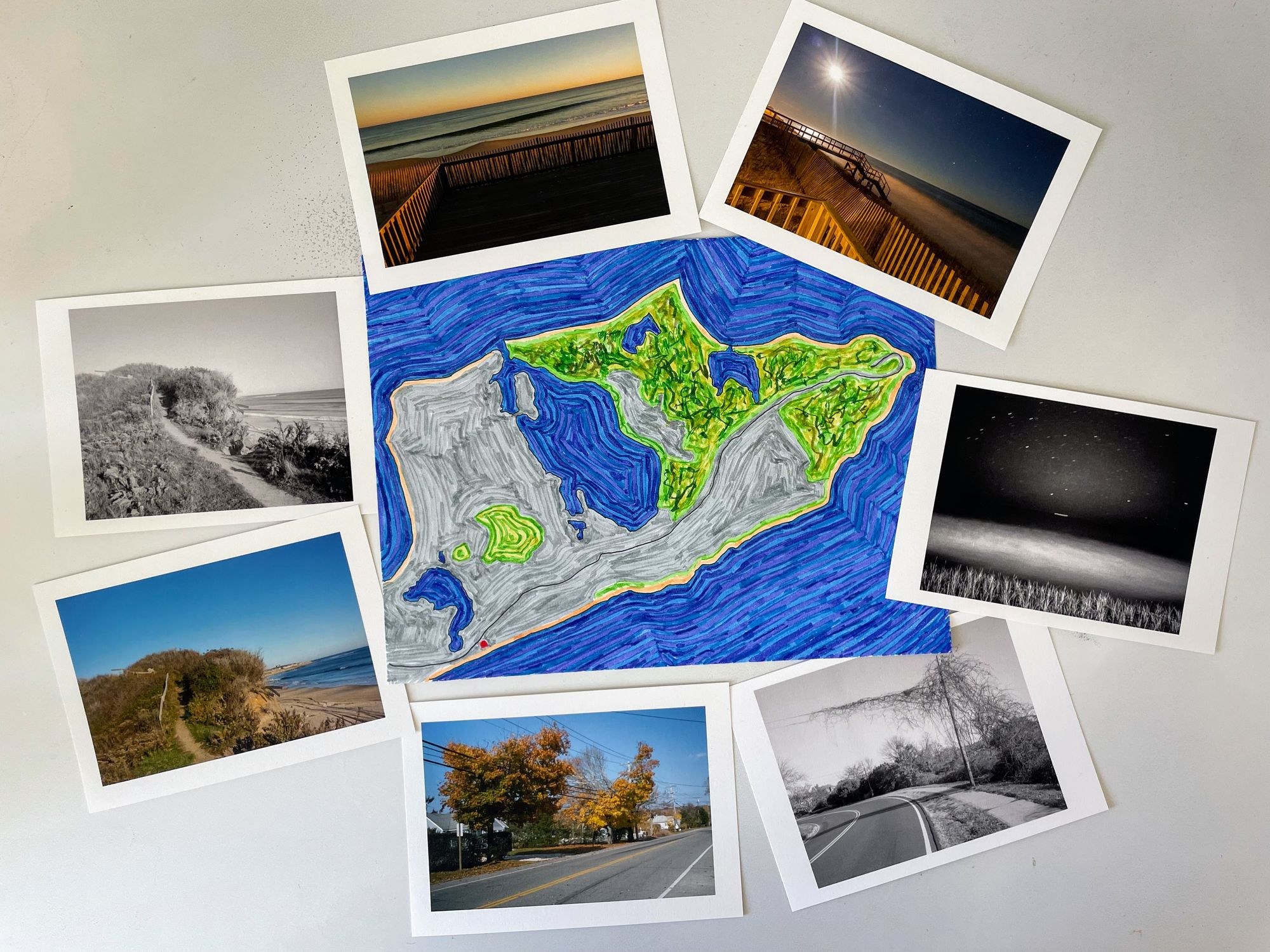
And sometimes, it makes me dream of Montauk, and a warm November weekend when I was blissfully roaming the trails along the Atlantic.
Inspiration
- Whatever the Problem, It’s Probably Solved by Walking: "Instead of viewing walking as simply the slowest way to get somewhere, I grew to see it not only as a means to an end, but as the event itself. And since I walked the Camino for a second time last year with my 19-year-old son, I’ve come to understand walking as among the most valuable things I can do."
- Los Angeles Reimagined - Bit by bit, nature is reclaiming the City of the Future: "Getting to that deeper level, I always say, 'Let's think about space differently,'" says James Rojas, an urban planner, community activist, and artist who grew up in East LA. "The first step is to change people's perception of the possibilities on the nation's land. We will never have enough money to change everything, but that doesn't mean we can't see transformation."
- When the Light, Shadow and Stars Aligned: Standing Where Ansel Adams Stood: "Once the team identified the region of the sky included in the Adams photograph, they used “computer planetarium programs to search the 1920s and 1930s for dates and times when a waning gibbous moon, with illuminated fraction near 85 percent, passed near this position in the sky,” Dr. Olson wrote. The search had originally turned up four possible dates. Using documentary evidence in the Ansel Adams Archive and lunar libration, a phenomenon that “affects the visibility of lunar surface features,” according to Dr. Olson, they narrowed down the possibilities. They concluded that Adams had made “High Country Crags and Moon, Sunrise, Kings Canyon” at 6:47 a.m. on Aug. 6, 1936.
- This is Your Brain on Art: "Many scientists believe we map other people’s actions into our own somatosensory system, which conveys sensation through the brain and body and helps us feel the emotions we perceive in others as if they were our own."
I’m an artist and marketing strategist from Saint Cloud, Minnesota. This is my newsletter on art, walking, urbanism and mindfulness.
Each issue, I share new work from my projects and try to make connections between ideas, articles and people that fascinate me. You can email me at info@bryanformhals.com or follow me on Instagram.